(84 - 28) 62970345
Hydrological Survey
We using a variety of sonar systems, qualitative and quantitative hydrographic surveys of the seabed. Hydrographic surveys take place in rivers, lakes, waterways, confined waters, and beaches.
Surveying and mapping tools needed to monitor coastal erosion, measure and map navigable waters, monitor coastlines and beaches, and provide data for programs storm damage, depth and mass calculations for dredging projects, locating and mapping submerged obstacles, and preparing for underwater and shoreline construction.
Hydrographic survey services we perform include: single beam sonar, multibeam sonar, side scan sonar, magnetometer, sub-bottom profiling,..
Hydrographic Survey

Otter Pro USV + Norbit iWBMS Multibeam Sonar & iLiDAR
The OTTER Pro had integrated system between a Norbit's iWBMS Multibeam and a NORBIT's iLiDAR Laser Sensor to recorded underwater data and both sides. This system is an efficient solution (reduce cost and schedule) for surveying in shallow water areas such as lakes, canals, rivers, ponds and harbour areas.
View in 3D
EdgeTech 3200-XS Sub-bottom Profiling
EdgeTech 3200-XS Sub-bottom Profiling System is a high-resolution wideband Frequency Modulated (FM) sub-bottom profiler utilizing EdgeTech’s proprietary Full Spectrum CHIRP technology. The system transmits a FM pulse that is linearly swept over a Full Spectrum frequency. The acoustic return received at the hydrophones is passed through a pulse compression filter, generating high-resolution images of the sub-bottom stratigraphy in oceans, lakes, and rivers.
View in 3D
EdgeTech 4200-MP Side Scan Sonar
EdgeTech 4200-MP Side Scan Sonar System provides a unique advantage over conventional dual frequency side scan systems by combining EdgeTech’s Full Spectrum and Multi-Pulse technologies into one unit. Providing high resolution images of seabed in oceans, lakes and rivers.
View in 3D
Nortek AWAC
Nortek AWAC is a type of device used to measure the flow of seawater or flow in other water environments. The device uses sound waves to measure the velocity and direction of water flow.
View in 3D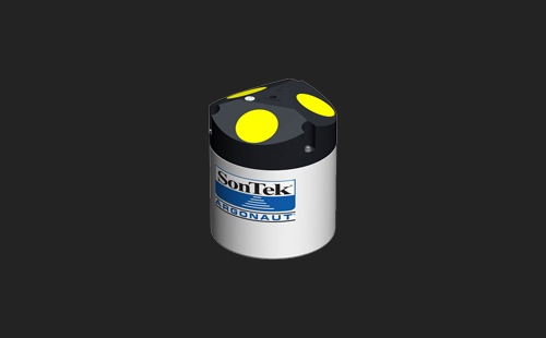
Sontek Agonaut-XR
Sontek Agonaut-XR is a type of water flow measuring device produced by Sontek company. It is one of the compact handheld water flow measuring devices. This device uses pressure measurement technology and monitoring software to measure the flow velocity of water.

Sontek Agonaut-ADV®
Sontek Agonaut-ADV® is a system for collecting underwater flow measurement data produced by the company Sontek/ Xylem Inc. This system is designed to measure velocity, depth, temperature, salinity, oxidation, and other parameters of water in freshwater and saltwater environments.
View in 3DBrands


Portcoast Digital Transformation Center
We provide digital conversion services in the construction industry. We research ways to apply digital conversion to the world of design and construction, creating a digital platform to optimize design, promote industrial construction processes, and use digital models.
Contact Us
328 Nguyen Trong Tuyen Str., Ward 2, Tan Binh Dist. , Ho Chi Minh City
(84 - 28) 62970345; 62970341
portcoast@portcoast.com.vn