(84 - 28) 62970345
3D Point Cloud Model
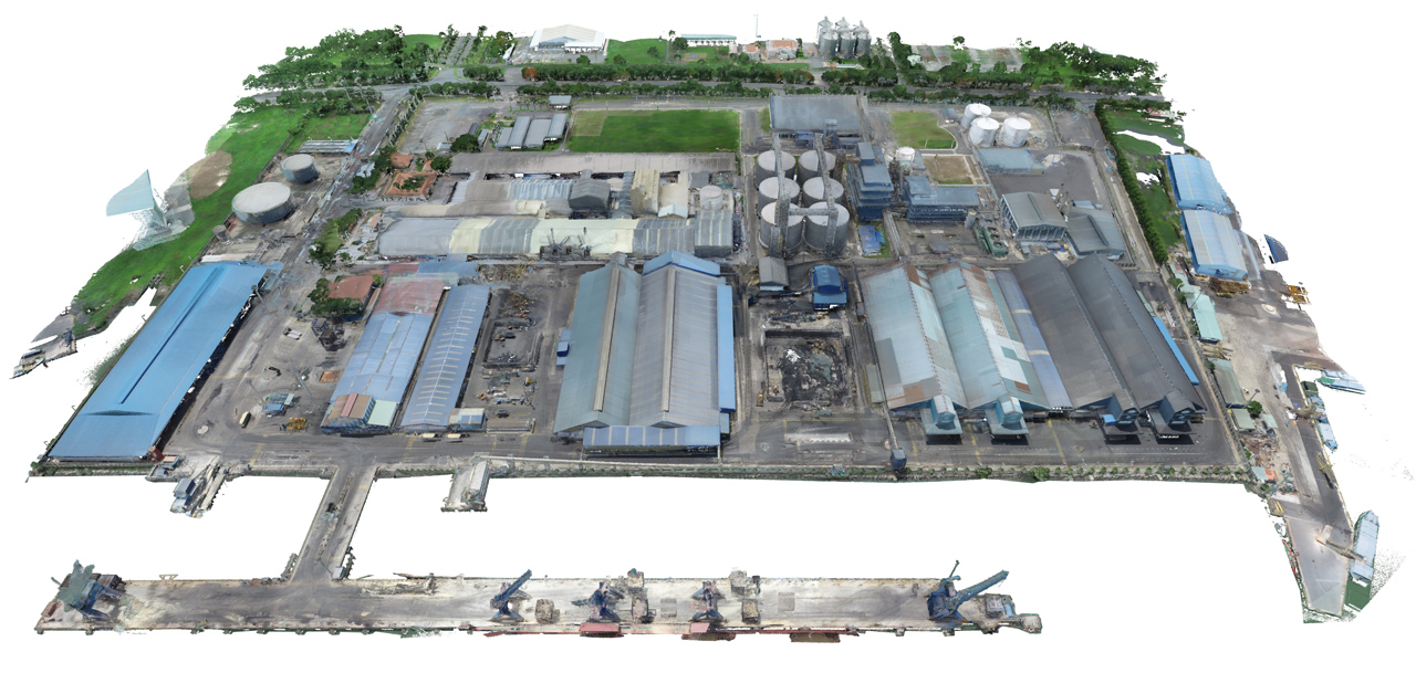
By using high-resolution 3D Laser technology, collecting spatial data of the environment is a fast and efficient way. The result is a 3D Point Cloud Model that provides customers with information about objects such as shape, distance, and the condition of structural parts such as flooring, sloping walls, skewed beams, crumbling foundations, or any other complex object within the scanning range of the machine.
We provide a TruView data sharing platform, point cloud data viewing mode, 360-degree images and design models, for users to perform measurements, display coordinates, etc.
Supported formats:
- PCG và RCS - AutoDesk
- IMP, PTX - Leica
- POD - Pointools & Bentley
The 3D point cloud data is used as input for products such as:
- Completion Inspection
- Creation of 2D, 3D CAD documentation
- Conflict Analysis & Deformation
- Volume Calculation
- Reverse Design
Many of our customers use this 3D point cloud data as a historical record of the conditions of the construction or site at the time of the survey. This data can be used to preserve historical structures, legal documents, construction progress surveys, etc.
Portcoast Digital Transformation Center
We provide digital conversion services in the construction industry. We research ways to apply digital conversion to the world of design and construction, creating a digital platform to optimize design, promote industrial construction processes, and use digital models.
Contact Us
328 Nguyen Trong Tuyen Str., Ward 2, Tan Binh Dist. , Ho Chi Minh City
(84 - 28) 62970345; 62970341
portcoast@portcoast.com.vn